Tag Archives: handmade paper prints

The Spanish American Wars of Independence

america vintage map poster
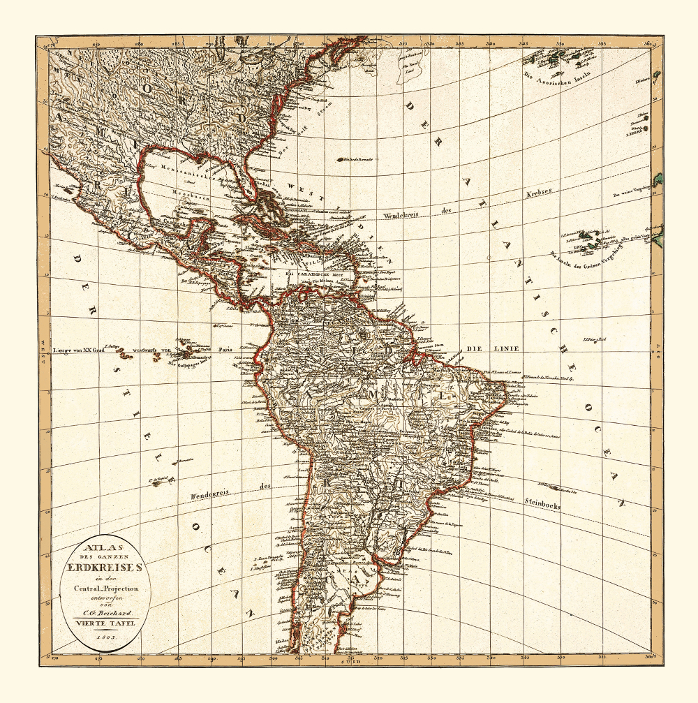
Map of America, 1803.

The early 19th century was a time of change in Latin America as the Spanish American wars of independence (1809-1826) completely reshaped the region. The political instability in Spain caused by Napoleon’s invasion gave rise to conflicts in the Spanish colonies in Southern America. The American Revolution (1771-1781) and the French Revolution (1789 – 1799) were the other two key factors that inspired the process of Latin American decolonization. During the wars, the Americans of Spanish Ancestry and the Mestizos gradually took over the administration originally controlled by Spanish-born officers. The Spanish resistance in America, especially in the regions of what are today Ecuador, Colombia, Venezuela, and Argentina created self-governing juntas and fought against the royalists. The conflicts resulted in the creation of the independent states that make up Latin America today.

Buy restored reproduction of this map printed on a high quality handmade paper here.

Brittany – the Hub for French Corsairs

antique map reproduction bretagne

Map of the Brittany / Bretagne, 1706.

This map of Brittany shows the beginning of the 18th century when Brittany flourished as a strategic base for the French Navy and seaborne trade. The seaports of Saint-Malo, Lorient and Brest underwent a rapid development. At the time this map was released, the port of Saint-Malo was also an important hub for the French corsairs. One of the most famous corsairs was René Duguay-Trouin who was a native of Saint Malo. Duguay-Trouin led a very adventurous life, capturing hundreds of merchant ships and warships.

His adventures also included being imprisoned in Plymouth, Devon, and later capturing Rio de Janeiro. Benerson Little’s “The Sea Rover’s Practice: Pirate Tactics and Techniques, 1630–1730” is a must-read for everyone interested in 17th and 18th century pioneering and corsairing. Duguay-Trouin’s tactics are also described in this book.

Buy restored reproduction of this map printed on a high quality handmade paper here.

Queen Ann Rules the Great Britain

old uk map

Map of the British Isles, 1702.

In 1702, Anne became Queen after William III (also known as William of Orange) died with no direct heirs in 1702. During her reign, England and Scotland united in 1707 into a single kingdom called Great Britain. Ann died in 1712 also leaving no direct heirs and thus was the last Stuart on the throne. Ann’s successor was her cousin George of Hannover. Would-be catholic claimants including Anne’s half-brother were ignored.

The story of Anne the Queen of Great Britain is told in Edward Gregg’s “Queen Anne: The Politics of Passion

Buy restored reproduction of this map printed on a high quality handmade paper here.

The Camino Pilgrimage way through the Northern Spain

northern spain antique map reproduction

Map of Northern Spain, 1606.

This map covers part of Spain that is today the autonomous communities of Asturias, Cantabria, Basque County, Castille and Leon, La Rioja and Navarra. This area is well-known to modern day pilgrims walking the Camino de Santiago pilgrimage. Two routes of the Camino lead through this area: the Camino Frances: from the Pyrenees (where it connects to the network of routes converging from all of Europe), passing the cities of Pamplona, Logrono, Burgos, Leon, Ponteferrada towards Santiago de Compostela; and Camino del Norte, which is a route mimicking the Biscay Bay coastline towards Galicia. Nowadays, the pilgrimage to Santiago de Compostela is very popular, and approximately 200 000 pilgrims walk one of the routes every year. This was not the case when this map was first printed in 1606, though. In the 17th century, the reformation movement continued to be active in Europe and wars were frequent in the 16th and 17th centuries, which made Spain extremely complicated for pilgrims to enter at this time. There are many books written about the Camino de Santiago from the pilgrim’s point of view.

Jean-Christophe Rufin’s “Immortelle randonnée” (in French, Italian and Czech) gives the reader a taste of the life of a modern pilgrim and the atmosphere of the Way in general. “Walk in a Relaxed Manner: Life Lessons from the Camino” by Joyce Rupp is another memoir from a pilgrim’s journey to Santiago.

Buy restored reproduction of this map printed on a high quality handmade paper here.

Africa’s Inland Still to Be Explored

africa vintage map poster

Map of Africa, Southern Europe and the Middle East, 1803.

In 1800, Egypt was under Napoleonic occupation and other parts of the Northern Africa were controlled by the Ottoman Empire. The rest of the continent was comprised of local kingdoms such as Buganda, Rwanda, and Burundi in South East Africa and included the Sokoto, the Oyo, and Benin in West Africa. Africa’s coastal areas were well mapped due to the European trade stations and frequent voyages along the coast. However, this was not the case for the continent’s inland; large areas remained unexplored due to difficult accessibility, the disapproval of the local population, and numerous tropical diseases. The major progress in European explorations of Africa in the mid-19th century was partly a consequence of the recent discoveries in medicine (quinine) and the weapon industry. The explorations proved that Africa’s interior was rich in raw materials and a real scramble to grab as large a slice of the continent as possible was started by European competitors. This period in the continent’s history is often referred to as the Scramble of Africa.

Travels into the interior of Africa” by the British explorer Mungo Park narrates an early attempt to map the continent’s inland.

Buy restored reproduction of this map printed on a high quality handmade paper here.


1640s – Crete Becoming an Ottoman Territory

vintage map reproduction of crete

Map of the Island of Crete (Candia), 1644.

This map shows the island of Crete during a particularly turbulent time. In 1644, it was still a Venetian colony and its official name was The Kingdom of Candia. After the Republic of Venice lost Cyprus in the 1570s, the Kingdom of Candia remained its last major overseas dominion. The Ottomans were set on the island due to its strategic position in the Mediterranean Sea. That year, Maltese ships attacked an Ottoman convoy that was heading from Constantinople to Alexandria. The convoy carried a number of pilgrims bound for Mecca including a woman who was believed to be one of the wives of the sultan and her son. The Maltese won the battle and took captives to be sold as slaves.

On the voyage home, the Maltese stopped in Crete to take on supplies. The Ottomans considered this act a breach of Venetian neutrality and declared war on the Republic of Venetia. Most of the island was conquered by the Ottomans in the early years of the war. The capital city of Candia (now Heraklion) resisted until 1669, thus making it one of the longest sieges in history.

Buy restored reproduction of this map printed on a high quality handmade paper here.

Fantasizing about the Earth’s Poles

travel decor map art

Map of the Polar Regions, 1690.

This map shows how people thought the Polar Regions looked before there were explored. The North Pole is marked Pole Septentrional Arctique on this map. Septentrional means “North” and the name is derived from the seven stars of the Big Plough constellation. It is clear from the map that the northern coast of Greenland, Svalbard and other islands in the Arctic Ocean were yet to be explored and mapped. The area around the South Pole on this map is captured as “Terra Magellanique Australis”, with Australis meaning south and Magellanique referring to the Portuguese explorer Fernando Magellan who explored the southern passage between Antarctica and Southern America. It was sometimes also called Terra Australis Incognita (The unknown land of the South), The Cold Land or Megallonica and it was a mythical land. Its existence was not based on any direct exploration, but rather on the theory that the land mass to the north should be balanced by a similar mass to the south. The Antipodes of Paris is marked on the map. This map is beautifully illustrated with pictures from Greek mythology. For example, there is the Horn of Plenty in the bottom left corner.

To touch the spirit of Antarctica, read Sara Wheeler’s “Terra Incognita: Travels in Antarctica”.

Buy restored reproduction of this map printed on a high quality handmade paper here.

The End of the Inca Empire

old map reproduction peru

Map of the Viceroyalty of Peru (an administrative unit of the Spanish Colonial Empire at that time), 1600.

By 1600, the last Inca Emperor had died and the Inca Empire had been under Spanish rule for over two decades. The Viceroyalty of Peru was established by the Spanish, which also included the areas of what is today Ecuador and Bolivia. Spanish supremacy was a major step towards the downfall of Inca civilisation. Many aspects of Inca culture were systematically destroyed by Spanish colonial officials. Several waves of epidemic diseases brought over from Europe by the occupiers were, even more, destructive: smallpox, measles, influenza and typhus ravaged the majority of the Inca population. To learn more about the Spanish conquest of what is now Peru, read “The Conquest of the Incas” by John Hemming or “In Search of an Inca: Identity and Utopia in the Andes” by the Peruvian author Alberto Flores Galindo.

Buy restored reproduction of this map printed on a high quality handmade paper here.

The Four Irish Provinces

ireland vintage map reproduction

Map of Ireland, 1834.

This map shows the administrative division of Ireland in 1840s. There are four provinces depicted: Connacht (marked in green), Leinster (pink), Munster (yellow) and Ulster (orange). This division is based on the historical Irish kingdoms. All of them feature their own unique emblem from medieval times. A concept called “Dindsenchas” emerged in early Irish literature as a poetic description of a place. According to one of these texts, the four kingdoms had the following characteristics:

Connacht is the seat of wisdom and learning; Leinster is the seat of prosperity and hospitality; Ulster is the seat of bravery and valour while Munster is the seat of music and the art.

Neil Hegarty’s: “The Story of Ireland: A History of the Irish People” provides an excellent guide to Irish history.

Buy restored reproduction of this map printed on a high quality handmade paper here.


Algiers – the Hub of the Barbary Pirates

algiers antique map reproduction

Map of the City of Algiers, 1575.

Algiers was an important hub in 16th century North Africa. The part of the Ottoman Empire covering what is today Algeria, Tunisia and Libya was governed from Algiers. Piracy and raiding were popular activities of the Algerian rulers at this time and they organised numerous slave-hunting expeditions to the Western Mediterranean. Large populations were affected, namely on the islands of Gozo, Lipari, and Corsica. Several decades later, the coastal regions of Spain and Portugal also became a target of the Barbary pirates’ raids. These slave-hunting expeditions eventually reached as far as Iceland in 1627. The famous Spanish writer Miguel de Cervantes spent five years as a slave in Algiers. He was captured together with the rest of the galley crew while in their way from Naples to Barcelona.

The Barbary Pirates 15th–17th centuries” by pirate expert Angus Kunstam and illustrated by Gerry Embleton is a great introduction to the era of piracy in the 17th century Mediterranean.

Buy restored reproduction of this map printed on a high quality handmade paper here.