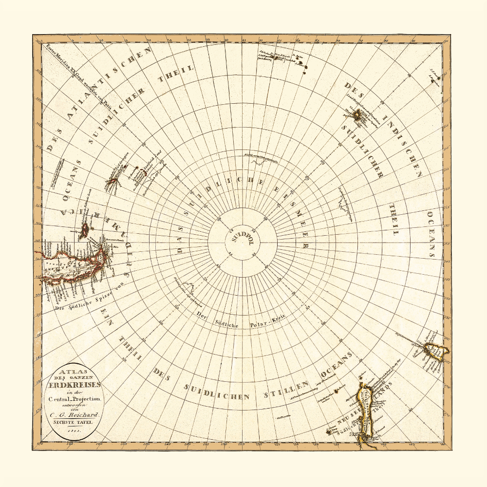
Map of the South Pole and the Adjoining Regions, 1803.
Long before Antarctica had been explored as a continent, there was frequent speculation about Terra Australia (Southern Land), a vast landmass located in the very south of the Earth, which balanced the continents in the northern hemisphere.
When circumnavigating the southernmost point of the South American mainland in 1520, Ferdinand Magellan believed that the land he was passing on the left side was actually an extension of the unexplored southern land. In reality, what he actually saw were the islands of Tiera del Fuego, the southernmost part of what is today Argentina. When Australia was discovered at the beginning of the 17th century, it was believed to be part of the Terra Australis. It was Abel Tasman who, about forty years later, proved that Australia was separated from the southern continent by the sea.
Captain James Cook first crossed the Antarctic Circle in 1772. Cook mapped a large part of the Southern Pacific and the Atlantic very well during his voyages and proved that Tiera del Fuego and New Zealand were not one landmass but were separated by the sea — a large ocean. It is now clear that Cook was very close to Antarctica and probably got as close as 240km (150miles) from the continent’s mainland. However, he never landed on its shores nor sighted land, as he was stopped by floating ice on his way further south. This is why this map, printed 30 years after his voyages, still does not depict the continent. Nevertheless, there are four zigzag lines representing Cook’s attempts to discover the southern continent, two of which can be seen within the Antarctic Circle.
Antarctica was finally discovered a couple of years later; the first sighting is documented in 1819 and the first landing documented in 1821.
Buy restored reproduction of this map printed on a high quality handmade paper here.