Tag Archives: greenland

The Ferro Meridian

grrenland iceland antique map reproduction

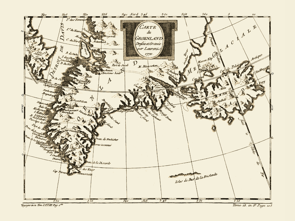
Map of Greenland and Iceland, 1770.

Passages from east to west Greenland are charted. The Ferro Meridian which was used in the history as a Prime Meridian crosses Iceland. It was established based on the longitude of the island of El Hierro, the westernmost island of the Canary Islands. Already since the era of Ptolemy (2nd century A.D.) the Canary Islands were considered the westernmost land of the known World. The Greenwich Prime Meridian was established by English astronomer and mathematician Sir George Biddell Airy in 1851. The Prime Meridian used today is the International Reference Meridian which passes approx 102m of the Greenwich Royal Observatory.

Authobiography of Sir George Biddell Airy” includes birth story of the Greenwich Prime Meridian.

Buy restored reproduction of this map printed on a high quality handmade paper here.

Denmark and Its Colonies in 1870s

map decor: vintage map reproduction of denmark

Map of Denmark and Its Colonies at That Time, 1872

In 1872 when this map was first printed, Denmark was recovering from the Schleswig wars, in which Schleswig-Holstein, now a German federal state, gained full independence from Denmark. Apart from Denmark and Schleswig-Holstein, the map shows the Danish Colonial Empire at that time: The Danish West Indies (now the United States Virgin Islands) in the Caribbean, Iceland (gained independence in 1944), Greenland and the Faroe Islands. The latter two countries listed remain part of the Kingdom of Denmark; however, full independence has been granted to both.

Buy restored reproduction of this map printed on a handmade paper here.