Tag Archives: world antique map

The World Map Showing Some Important Exploratory Voyages

beautiful world map poster

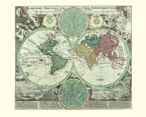
Map of the World, 1720.

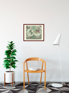
This is a map overflowing with information. Some of the most important geophysical and climatic phenomena are described in the bottom part with specific descriptions and examples of volcanoes, earthquakes, ocean currents, vortices, winds, rains and rainbows. The unexplored areas of western Canada and Alaska together with the Canadian islands in the Arctic Ocean and the Northern Coast of Greenland are called Terra Esonis; this was a mythical land, similar to Terra Incongita Australis in the Southern Hemisphere. Tasmania bears its first name after being explored by Abel Tasman: (Van) Diemen’s Land. The name was only changed to Tasmania in 1856, more than 200 years after Tasman landed on its shores in 1642. The most recognised sea voyages are marked on this map; besides Tasman’s sailing, there are also the voyages of Ferdinand Magellan and Fernao de Lorinha marked on this map. The two smaller circles show the Star Constellation of the north and south skies.

Buy restored reproduction of this map printed on a high quality handmade paper here.
All the Beauty of the World

In our February focus, we present antique World maps in our catalogue:

1) World: Vintage Map Art, 1633

old world map poster

antique map of the world

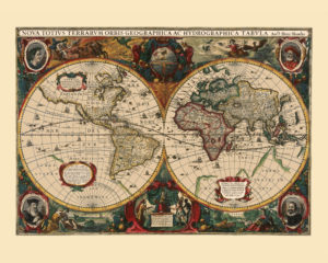
Australia and Antarctica were not yet fully explored at the time this map was first printed and are shown here as “Terra Incognita” and “Unknown land”. The illustrations in the corners in the map represent the four elements: water, earth, air and fire.

2) World: Vintage Map Poster, 1680

historical world map

Beautiful World Map with rich illustrations.

3) World: Old Map Poster, 1720

antique world map poster


old world map

The heavens with a description of various geophysical and climatic phenomena are depicted on this map.

4) World: Beautiful Old Map Print, ca 1705-1730

beautiful world map poster


old map of the world

Five climatic zones (two cold, two mild and one warm around the equator) are shown. The main maritime routes are also marked. In the first half of the 18th century, exploration of Australia was still underway and it was believed that it was a part of Terra Incognita, a land located in what is now Antarctica. This map is accompanied by a list of selected countries in America, Africa, Europe and Asia and their capital cities are listed. Furthermore, the most frequent geographical terms are defined.

5) World: Antique Map Reproduction, ca 1750

old map of the world


vintage world map poster

Various solar system ideas are depicted on this World map.

6) World: Vintage Map, 1770

antique world wall map


beautiful world map

The World is shown in several projections.

7) World: Vintage Map Print, 1786

antique map of the world


world old map

This French map of the world from 1786 depicts all three recent voyages of Captain James Cook and his crew.

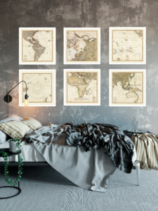
8) The World in a Set of Six Maps, 1803

wolrd vintage map

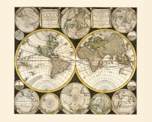
The set consists of:

Map of the South Pole and the surrounding regions of South America, New Zealand and Tasmania, 1803.The continent of Antarctica had not yet been confirmed in 1803; the first documented landing on Antarctica took place in 1821.

Map of the Arctic Ocean and the surrounding regions of Europe, Asia and America, 1803.

Map of the Pacific Ocean and the North-West of America, 1803.

Map of America, 1803.

Map of the African continent and the neighbouring regions of the Middle East and Southern Europe, 1803.

Map of Southeast Asia, the Indian Subcontinent and Australia, 1803. The coastline of Australia had not been fully explored and mapped in 1803. The first complete chart of the Australian coastline was mapped by Matthew Flinders in 1810.

17th Century – Exploration of Australia

beautiful world map reproduction

Map of the World, 1680.

The map shows that there were still many parts of the world unexplored in 1680. These were some of the islands in the Arctic Ocean (back then called Oceanus Septentrionalis – The Northern Ocean, named after the seven stars of the Big Plough star constellation); also Alaska, Antarctica, Australia and New Zealand.

The most important explorations of Australia took place in the 17th century. The first documented European landing on Australia was in 1606 by the Dutch navigator Willem Janszoon. Ships from the Dutch East India Company continued to explore the Australian coastline over the following years. In the 1640s, the Dutch captain Abel Tasman set out on two voyages; during the first voyage he explored and mapped the Northern coast of the continent that he named New Holland. It is under this name that Australia is shown on this map. During his second voyage, Tasman explored Tasmania (Van Diemen’s Land) and New Zealand. The last parts of Australia’s coastline were those most densely populated today: New South Wales, Victoria and South Australia.

Buy restored reproduction of this map printed on a high quality handmade paper here.