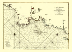
Map of the Southern Coast of Brittany /Bretagne, 1693.
This map brings us to the end of 17th century when Brittany fully benefited from its strategic position between Spain, Britain and the Netherlands and played a leading role in France’s naval expansion – Bretons constituted an important component of the French Navy and contributed to the colonisation of the New France and the West Indies.
Buy restored reproduction of this map printed on a handmade paper here.


