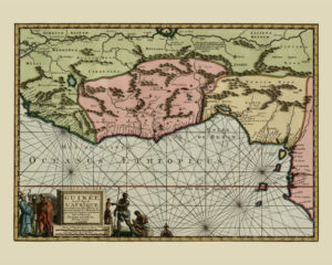
The first European bases were established in the Gulf of Guinea in the 15th century; first by the Portuguese, followed by the Dutch, the British and the French. These served as hubs for trading goods and supplying stations for convoys of ships voyaging further south. In addition to the goods, the slave trade began almost immediately after the Portuguese arrived who took captives to use as slaves back in Portugal. After Columbus voyaged to America and new colonies in the West were established, the demand for labour had risen rapidly, and the Atlantic slave trade began on a large scale. The trade was legalised by the Spanish and the English Crowns.
The Atlantic slave trade reached its peak during the 17th century. It is highly likely that many of the captives were taken during wars between the local rulers who were trying to meet the demand for slaves. The slave trade is also one of the possible reasons why the Songhai Empire (an important large Empire in the Gulf of Guinea Region) split into several smaller states.
Gold, spices and ivory were the main items traded between Africa and the rest of the world. Some parts of the Gulf’s coastline were later named after these: Slave Coast (present-day Benin), Gold Coast (present-day Ghana), Ivory Coast (Cote d’ Ivoire) and Pepper Coast (present-day Liberia).
